Friday, May 23, 2014

THE REST OF AFTER MOAB

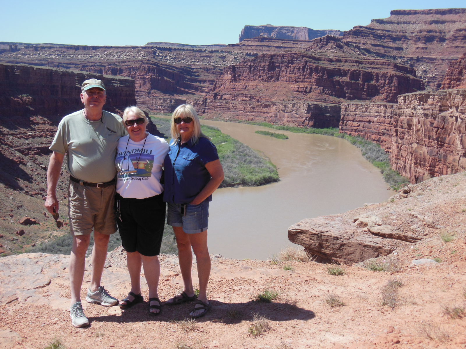
The small town of Monticello in eastern Utah is so close to Colorado that if you stood on a chair you could see it.  It is also within spitting distance of Hovenweep National Monument and Canyons of the Ancients. two places that we have never been to.  Cathie wasn't too keen on visiting more Anasazi ruins, but I agreed to limit the number and include a lunch in nearby Cortez.

The P.C. police are alive and well in the National Park Service and the BLM.  For as long as I can remember the people who inhabited the 4-Corner region  a thousand years ago were referred to as Anasazi. The word Anasazi is Navajo for Ancient Enemy most likely because the Navajo considered them their ancient enemy.  But today's Pueblo inhabitants are thought to be descendants of the Anasazi and we wouldn't want to offend them. So now we will refer to them as Ancestral Puebloans.  Today's publications handed out to the public at various sites in the area make no use of the word, "Anasazi". BUT, the BLM still operates the Anasazi Heritage Center in Dolores, Colorado.

So first up was Lowry Pueblo in the Canyons of the Ancients.  This is just one of the over 6000 archaeological sites in the Monument.  With 6000 sites I could spend a lot of time here, but a deal's a deal.


The ruin contains 40 rooms, some of which have been protected from the elements with a huge steel roof. Only a few of the rooms are open for exploration.

   
This is the Great Kiva, 47 feet in diameter, was once covered with a roof structure.  The kiva and the pueblo were built around 1160 and was occupied for about 165 years.  The main building was 3 stories high and included 8 kivas.

We made a quick stop at nearby Hovenweep National Monument and checked out a couple of the ruins.  Most of the ruins in Hovenweep sit on the canyon rims with a few ruins in canyon bottoms.


Interesting how some of the buildings are situated on the top of boulders.  The location of some of these structures suggest that they were for defensive purposes.

In keeping my part of the bargain we headed towards Cortez for lunch.  The area around Cortez is dotted with farms growing alfalfa, potatoes and wheat.


As we drove along this lonely road, just about every car that passed us going the opposite direction, the driver waved.  So too did farmers working in the fields and folks we saw in their yards.  You don't get much of that in Southern California.  You also don't get a reasonably priced lunch like we did at Jack and Janelle's Country Kitchen in Cortez.  We had breakfast at this spot several years ago so we figured to give lunch a try.  For less than $20 we and a great lunch which included the salad bar.

With the trip almost over we headed for our last stop in Flagstaff.  We stayed at one of our favorite B&B's, the Conifer House located in a nice residential area of town.  Large rooms with fireplaces and Jacuzzi tubs it was a great way to end our trip.


HAPPY HOUR IN THE COURTYARD


                                                                                NOW THIS IS MY KIND OF CAMPING!

For the most part we had a great trip with only a couple of downers.  The toe incident kept us from hiking and exploring more areas.  The insect bites in the tent made camping an unpleasant experience, but the upside was that Cathie got to sleep between sheets on most nights.

Till the next adventure............


Wednesday, May 21, 2014

MORE OF AFTER MOAB

So after tossing the mattress we headed south spending sometime exploring Upper Butler Wash, an area we've been to before.  I've finally been able to put my boots on so it was time to burn some calories.  The last time we abruptly ended our exploration when we came across a guy who had seriously injured his knee. You can read about it HERE.  So we returned to finish our exploitation.  A short hike up the wash, which has a small stream, we spied a trail heading up the bank, which means perhaps there is something there.  This is what we found.


This ruin is call Target Ruin and due to it's location it is impossible to get inside it. That is probably one reason why it is in such great condition.  The plaster remains on some of the structure and much of the roof.  To get a better look we climbed up the opposite side of the canyon to an alcove.  If  you look closely in the photo below you can see another ruin on the left and something behind the trees in the alcove.


CATHIE ON THE WAY UP

Once inside the alcove we saw evidence of habitation with the remains of a structure and some grinding areas on the rocks.


On the wall of the alcove we found this petroglyph which looks like a "target"


Looking across the canyon at the main ruin, you can see the same "target" painted on the wall inside the ruin.


In the next photo you can see the remnants of the same target in the upper half of the wall. 


For me, someone who really likes exploring these ruins this was one of the better ones I've seen because the paintings are still visible.

UPPER BUTLER WASH

It was time to head to our next overnight stop in Bluff.  Since the tent had been ruled out we found lodging at the Recapture Lodge.  From the web site:

"Recapture Lodge has been an oasis for Southwestern visitors for over fifty years. Shady picnic areas offer relief from the southwestern sun. Self guided walking and mountain bike trails take visitors from Recapture Lodge to the San Juan River. 
Slide shows are presented in the lobby for guests by local geologists, archaeologists, naturalists and other interesting people as scheduling allows."

We've stayed at the lodge before, just really an old motel with character.  Breakfast is self serve and payment was on the honor system.  Toast? 5 cents, a bowl of cold cereal 25 cents, coffee was free.  Then someone complained on the web site Tripadvisor that they were being nickeled and dimed.  I guess you could say they were.  It was a 50 year tradition that ended with the complaint.  Now it's free.

The next morning before the heat, we drove to River House Ruin located about 5 miles off the highway on the San Juan River.  The 4-wheel drive road in wasn't too bad except of this one spot.


The location on the river was not just home to the Anasazi, but in later times there was a trading post and cattle operations.  The ruin has easy access and you can enter it and explore.


It is quite common to find corn cobs in the ruins in the area.  Corn was grown by the inhabitants and was a staple in their diet.


Cathie opted to sit in the car while I explored.  She told me that she was ruined out. In fact she said she didn't care to see another ruin....ever.  I figured I better listen to her, at least for the time being.

Because camping has been cancelled on this trip the planned route had to be adjusted.  We turned around and headed back to the north driving through the Valley of the Gods on our way to Monticello.

VALLEY OF THE GODS


VIEW FROM MULEY POINT

In Monticello we stayed at the Grist Mill Inn B&B.  Very nice accommodations in an old flour mill.  This brings up and interesting comparison.  Cathie really liked this place so it was had for me to understand why she didn't like ruins.  I mean both places were really old and corn was ground in each.


Sunday, May 18, 2014

AFTER MOAB

For those that know me, know that I like finding and exploring Indian ruins.  One area that I've been wanting to go to for a long time has been Beef Basin.  Forty miles by both dirt and 4-wheel drive roads this was one of the reasons for this road trip.  We left Moab after a great breakfast at the Moab Diner and drove south towards the Needle District of Canyonlands N.P.  At first the road into Beef Basin is a good graded county road which at 40 MPH smooths out the washboard surface.  The road climbs up to over 8,000 feet before descending into Beef Basin.  The area is call Beef Basin for a reason.


The area has been used for the grazing of cattle for over 100 years, but long before that between 900 and 1200 AD,  Indians farmed here.  There are numerous ruins in the basin, some small and others large.   Most are difficult to see and you really need to keep a lookout for them as they are sometimes hidden in the trees.  


This is Farm House Ruin, on of the largest in the area.  How they know this is any one's guess, but apparently this building was occupied during the 11th and 12th centuries and was home to people farming in the area.

TOWER RUIN


We spotted this small ruin while driving down the road. It was just a chance glance in it's direction.  I'm am sure we drove right past many ruins hidden among the trees.

BEEF BASIN

We were going to camp in the basin but when we found a camping spot, the flying bugs were so thick it became miserable within minutes.  We opted to head to higher and cooler ground.  We found an ideal spot overlooking Salt Creek Canyon and the National Park.


The next morning we discovered we were covered with some type of insect bites.  We had been experiencing this after each night in the tent.  It wasn't mosquitoes, and upon closer inspection our foam pad had some spiders crawling about.  So the first town we hit we disposed of our mattress.  This made Cathie extremely happy as it meant B&B's and motels for the rest of the trip.

More to follow.....


Saturday, May 17, 2014

THE REST OF MOAB

With just two days left before being kicked out of the townhome, we made best use of our time with, what else, more driving in the dirt.  Wednesday had us heading east up the Colorado River to Dewey Bridge which at one time was Utah's longest suspension bridge which was built 1916.  Unfortunately in 2008 a boy camping nearby and playing with  matches started a fire which spread to the bridge destroying it.


THAT'S ALL THAT'S LEFT

From the bridge we turned off the highway for the long 17 miles to the Dolores River Overlook.  The road, graded much of the way past through both boring and spectacular scenery.  The view at the end of the road made it all worth while.


THERE'S THAT SNAKE AGAIN


Made it back to town in time for happy hour and then out to dinner at the local cowboy bar/restaurant.

The next morning Gary and Diane headed for the barn, but Don and Dorothy joined us for one last outing.  We headed out to Islands in the Sky in Canyonlands N.P. and took the Shafer Trail down the switchbacks to the canyon bottom.  About 4 years ago we headed down this road and since then it has been greatly improved.  So much so that it could be driven in a passenger car.  Still scary though as the road hangs on the edge of the cliff on the way down.

DON ON THE WAY DOWN

THAT'S WHERE WE'RE HEADING


WE CAME DOWN FROM UP THERE

THE TRAVELERS AND THE COLORADO

BEAUTY AMOUNG THE THORNS

MORE MUD AND I JUST WASHED IT.

We called it a short off road day as we had to ready the townhome for our exit.  Don and Dorothy invited us to a final happy hour at their campsite on the river.  We had a great time in Moab and hooking up with Don and Dorothy after a year was an added bonus.  In the morning we got and early start and headed out for parts south.

STAY TUNED..........